
_edited.png)
_edited_edited.png)
Crossing Canada Day #10: Entering the Badlands
- Jaime Lee Lightle
- Mar 9, 2022
- 5 min read
Updated: Mar 24, 2022
We continue our Chronicles of Crossing Canada. Welcome back!
We left Tunnel Mountain Campground at around 8:15 A.M. and took the much recommended 10-minute drive to Lake Minnewanka, just 20 km from Banff, Alberta.

Jaime Lee:
As our truck made its way to the lake, every direction we looked we could see the Rockies glowing in the morning sun. Just a 10 minute drive and we arrived at a carpark. There was a marina to our right where one could catch a boat charter, to our left, a restaurant. It was too early for the hordes of tourists – only a handful, including us. We walked towards the shore and voila – magnificent! A huge, clear, turquoise lake surrounded by steep peaks. A pebble beach is where we stood to take photos. A flock of seagulls and a raven on a lamp post greeted us. We felt like all was well.
Back in the truck and away we go! This time, our destination was Cypress Hills Interprovincial Park in Saskatchewan.
Leaving the Rockies behind, I felt a little bit of relief. It was a tough, albeit worthwhile experience driving through the Rockies, but I was now looking forward to the straight, flat roads of the prairies. Alberta flattened our fast as we got closer to Calgary where we missed the by-pass and ended up driving right through the city. It was a pretty nice city but Jim cursed the whole way through.
Soon after leaving the boundaries of Calgary, we started seeing fields of Cattle and oil pumps – ah, the badlands and the borderlands between Alberta and Saskatchewan.
Dried ponds, some with no more than a puddle of mud-water for the herd of cattle making their way down the slopes of the Cypress Hill plateau – we were now in Saskatchewan. We saw coyote, bison, springbok as we drove. There were no trees except on the plateau (a real high dessert).

We were relieved to be back in the sparsely populated, rural, no-mask wearing part of the country again. One thing I noticed about driving in the prairies, you cannot rely on any trees to indicate the direction and force of the wind unless you can find a blade of grass or tumbleweed.
To get us to the park, the Apple GPS took us off the trans-Canada Highway and on to a dirt road, bypassing Maple Creek (we will explore tomorrow) and up the geological formation where the park sits.
We got through the park gate and made our way to the general store to get some supplies. In under 5 from leaving the store, we were at our site. We got the truck-house posts firmly on the ground and assessed our new home: trees, privacy, fire pit (yaay), water, electricity – we were all set!

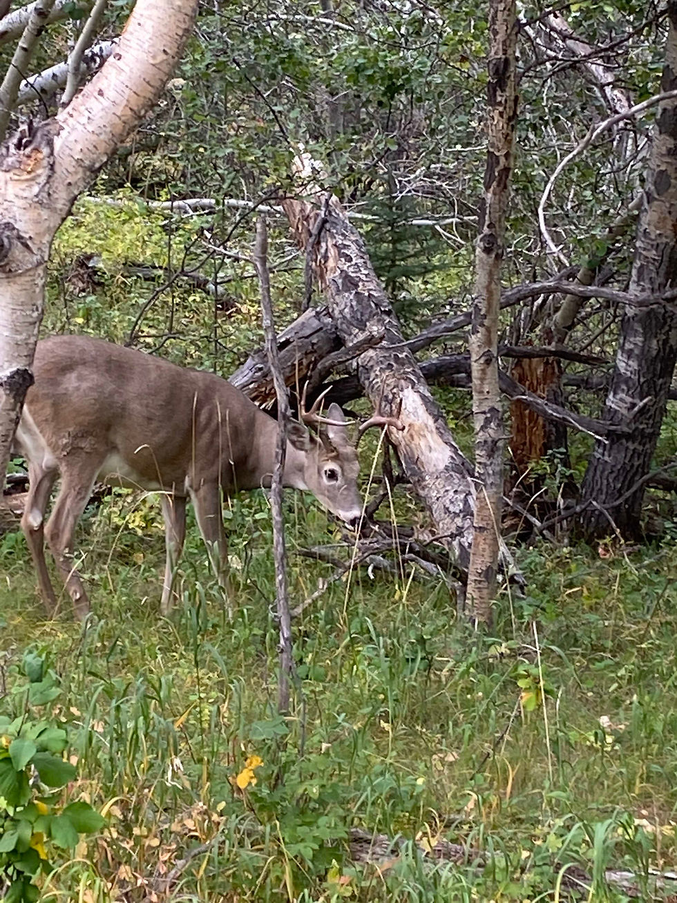
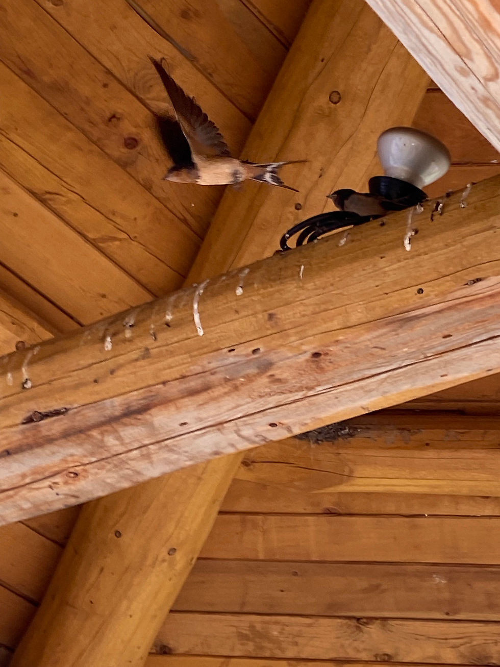
After we emptied our bladders, we grabbed the park map and went forth to explore the park via their trail system which is a part of the Trans-Canada Trail system. We passed through campgrounds, a horse ranch, mini-put, a pizza parlour, golf course, visitor’s centre, pool, restaurant and pond. We sat in a gazebo at Lock Lebeln Lake and watched a pair of birds feed their young who were nested in the rafters of the gazebo. I noticed a deer in the woods just off the trail – she was so close!
After getting back to camp an hour later, we noticed we were situated close to the dark sky observatory. The skies were filling up with clouds so there was little chance of any star gazing for us.
As the sun sank below the horizon after supper, we could really feel the coolness of the desert. Sitting by our fire with snacks, the evening air carried the sounds and conversation of our camp neighbours. Behind us, a group of cancer survivors shared their stories with strong laughter.
Just as our last piece of wood turned to embers, we started packing up for the night, then the drip, drip of rain started falling. We packed ‘er in at almost 11pm (new time zone). We were comfy and dry in the truck-house, and we were grateful for another day of safe and memorable travel.
Jim Writing again…..
We woke up in Banff National Park, the sun was shining ever so bright, smashing daylight over the lovely peaks surrounding us. We decided to take our camp neighbour’s advice and headed to lake Minnewanka. The sun was peaking its beautiful light around the peaks as if it was playing peek a boo with us. Such a blue lake. The sun broke over the mountains and with it came a feeling of peace and of happiness. Today was a great start. Heading towards Cypress Hill Interprovincial Park, the highest point between Torngat Mountains in Labrador (elevation 1,652 meters) and the Rocky Mountains. Sitting on the border of Alberta and Saskatchewan, its highest elevation is 1,466 meters. There, on this plateau exists a forest that stands above the prairies. Theses pine forests survived the great flood, standing strong. While driving, I pointed to a forest on a hill and said to Jaime: “I bet that is where we end up for the night”,and I was correct.

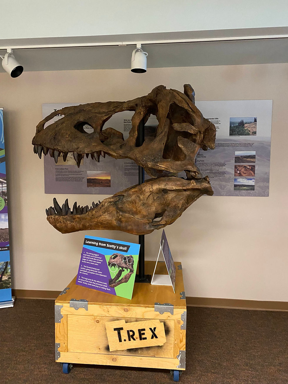
We set up camp and watched as other campers were getting their large Campers parked in situ. Us, we just backed the truck up and parked. We decided to go for a walk to explore more of the park. The trail was called the Moose trail and was dotted with painted Moose prints along the paved path. The trail headed down to the lake. We were surprised to see groups on Mennonites who were also enjoying the park. They seemed to be enjoying the scenery as much as we did. In the Interpretive center, which was closed for the season, had a selection of pamphlets to help one learn more about the area. We grabbed some for later reading. A large T- Rex head was behind the locked-up portion of the interpretive center. Dinosaurs once walked this area also. It seemed to be a place lost in time. Beautiful in all its glory.
We walked back to camp following the moose prints yet instead of a moose, it was another deer following us on the path. Glimpses of peace. Back at Camp we started a fire, the fire pit which was like no others we have seen to this point. I took photos of it for future reference. I might have to make something similar someday. Everyone around had a nice fire going. I realized that we were basic camping people. Some people brought wood splitters, quads, satellites, and televisions galore. We brought the basics and that was the just perfect for me. This area had a charm similar to the Great Canadian Shield of Northern Ontario. Quiet and peaceful. Tomorrow we will be heading further east heading towards our Nova Scotia home. Yet tonight we are in Saskatchewan in all its glory.
Did you enjoy this blog post? Let us know.

Want to read more? Sign up now.


Comments